
NFP - Center of Foundations and Prospecting
NFP works are including of: Testing and analysis of piles, site investigation, geotechnical monitoring. We have the ability of analyzing complicated geotechnical engineering also, such as the design and general analyzing calculation for soft foundation, reclamation, stability of sea dyke and slope, pile foundation and deep excavation, etc. All of our works are according to international standard (ASTM, BS, etc.) and “Regulamento de Fundações”.
1. Testing and analysis of pile foundations
Perform tests and provide analysis of deep and shallow foundation, which are generally used for large and medium projects (LRT, Public House, Bridge and Terminal) in Macau. Field tests are including in pile static loading test, pile dynamic loading test, pile sonic integrity test, pile driving analysis, koden test, cross-hole sonic logging test, anchor pull out test and pneumatic drilling test. NFP has many experienced engineers and technicians for pile tests with advanced test equipments.
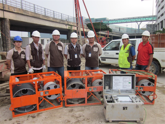
(Pile Test Team)
1.1 (Pile Sonic Integrity Test, SIT)
Sonic Integrity test is a kind of non-destructive test. This test is used to test the integrity and continuity of a pile rapidly and economically. The method of this test is to strike the pile head through a specific hammer by hand and use an instrument to receive the refl ected wave. Through computer analysis to check the abnormal conditions like crack, necking or soil inclusion, etc. This testing method is usually used in PHC pile but now also used in cast in-situ pile.
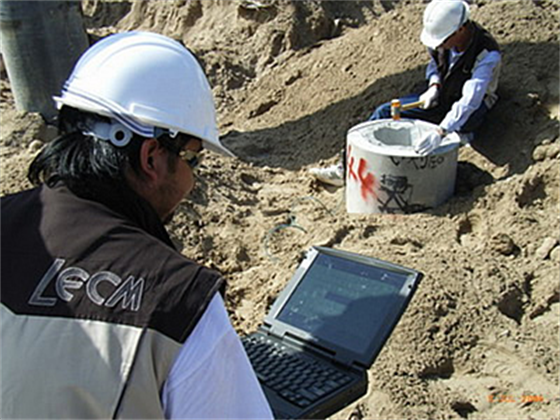
(Pile Sonic Integrity Test, SIT)
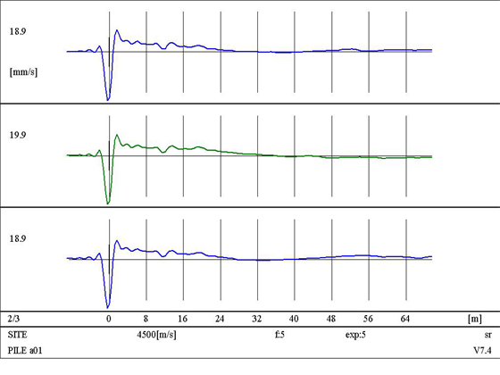
(Test Results of SIT)
1.2 (Pile Dynamic loading Test, DLT)
Dynamic loading test is a kind of quick, reliable and economically method to test the capacity of pile. It is always used in diving pile, bored pile and cast in-situ pile. Besides of capacity, DLT can also provide the resistance distribution (pile and pile head) of soil, and check integrity, quality and defects. DLT applies an axial impact loading to a pile head, produce enough penetration to check the stress of pile particle and the response of acceleration for real-time analysis. The signal can be used for further analysis by computer program (signal matching). Every DLT final report shall include a simulation of static load result, to produce the curve of load – settlement.
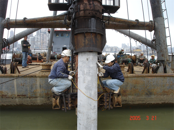
(Installation of test sensors on sea)
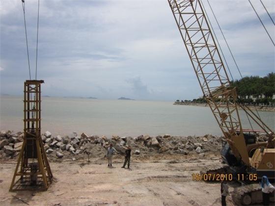
Falling hammer
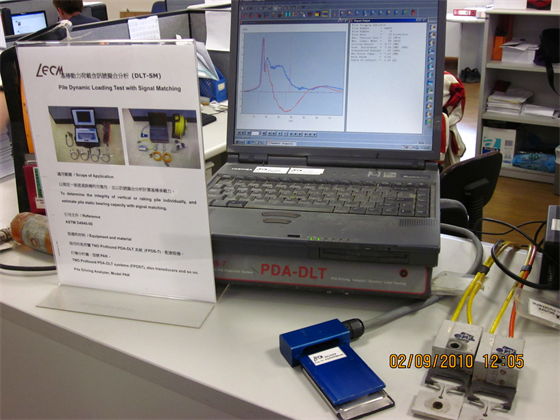
(DLT signal matching system)
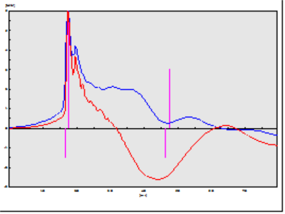
(Test results of DLT)
1.3 (Static loading Test, SLT)
The method of Static loading test is to apply loads on the testing pile using a large amount of concrete block or usually in reaction pile system. After four cycles of loading and unloading processes, measure the settlement and thus analysis the capacity of testing pile. Strain gauges should be installed also at different depth of testing pile for analyzing side friction of the foundation soil, giving additional information for pile design works. High-accurate 8000KN or 10000KN Dynamometer WIGAbloc Elasto load cells are used in the process of tests.
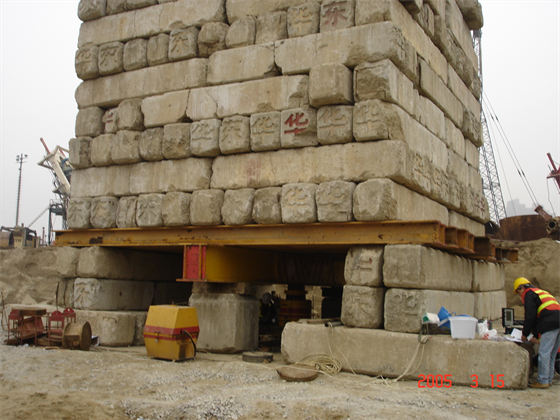
SLT platform
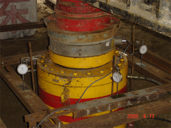
System for hydraulic jack, load cell and dial pressure gauge
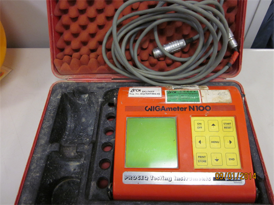
Display for WIGAbloc Elasto load cell
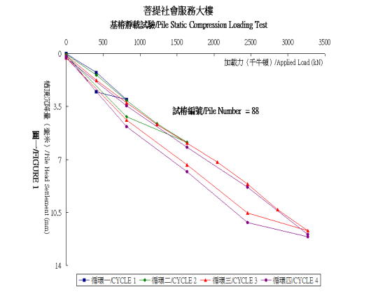
Test Results
1.4 Koden Test
Cast in-situ pile (Bored pile) shall be performed Koden test for inspections of the diameter, verticality and bell-out diameter of the pile hole. The method of Koden test is to drop down an instrument along pile hole to the bottom. The instrument will transmit ultrasonic wave to the pile wall and receive refl ected wave during the drop down process. Diameter of testing pile hole should be from 0.5m to 4.0m and the depth should be 100m. NFP was in charge of a large amount of Koden test of cast in-situ pile in Macau.
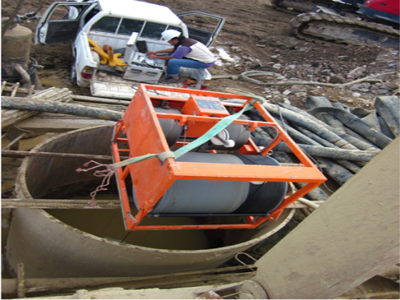
Koden Test
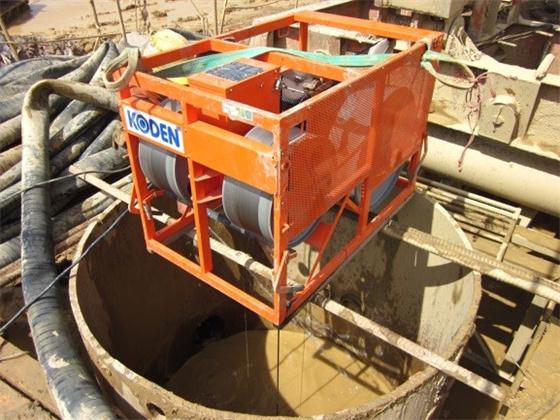
DM-604 Ultrasonic Drilling Monitor
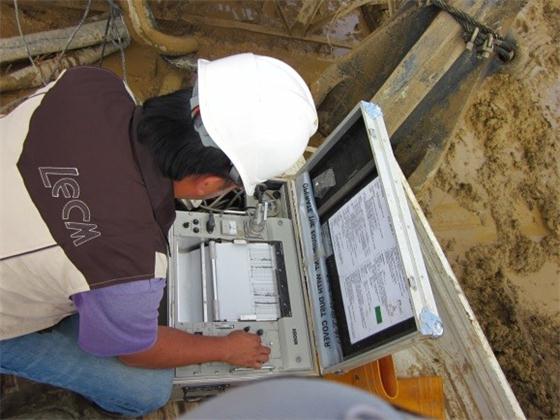
Test Recording
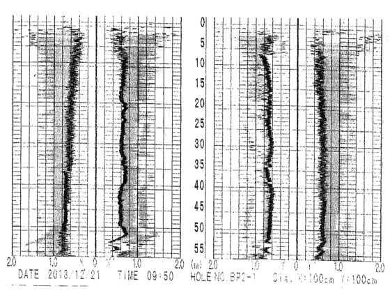
Test Results
1.5 (Cross-hole Sonic Logging Test, CSL)
The method of cross-hole sonic logging test is to plant several metal pipe to a certain depth at a cast in-situ pile before concreting. After concreted and 7 days age, drop down sensors at the same time to the bottom through two metal pipes and then pull up. In this process, the sensors will transmit ultrasonic wave and receive refl ected wave to check the quality of concrete pile and analysis the completeness of the pile. CSL is also available for inspection of completeness of diaphragm wall also.
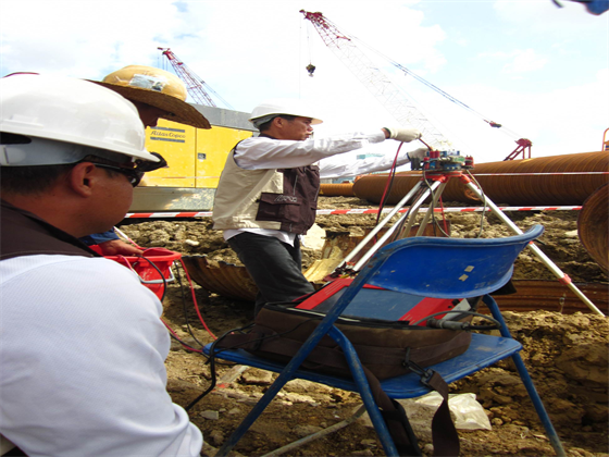
Installation of CSL instrument
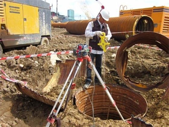
Measurement of pile depth before CSL testing
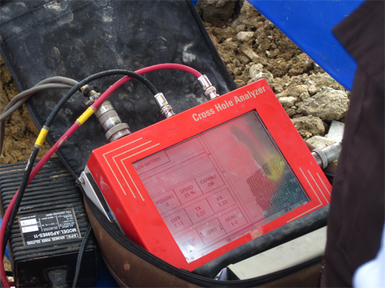
Test recording
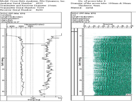
(Test Results)
1.6 (Anchor Pull-out Test)
In the construction of slope and retaining wall, there are two kinds of anchor, rock anchor and soil anchor. After insert the anchor to a designed depth and fi xed, use an instrument to apply a tension force at the end of anchor. Through the elongation of the anchor, we can assess the tensile strength, material and the construction quality. Besides, usually there are some steel bars remain on the pile head to connect superstructure in pile construction. Apply a tension force to that steel bars also can assess the tensile strength, material and the construction quality through the elongation.
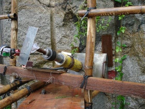
Anchor pull-out test on slope
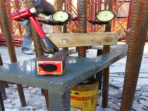
Pull-out test for steel bar
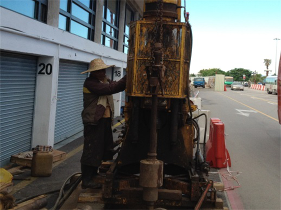
1.7 (Pneumatic Drill Test)
Pneumatic drill test is usually used to check the rock property. The method of this test is to drill a drill pile to the rock layer through certain compressed air pressure by Pneumatic drill machine. Through the required time needed for drilling a certain depth to decide whether this rock layer can be the load-bearing layer. Parameters of instrument of Pneumatic Drill Test normally are 35kg weight, 25mm diameter of pile or drill, 7bar compressed air pressure. The required time of drilling 300mm depth of the rock layer is less than 2 minutes.
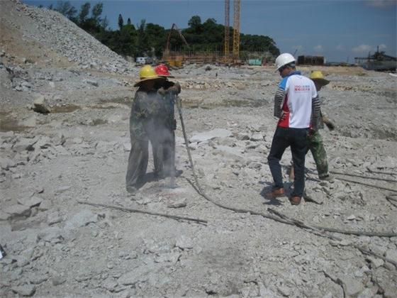
Pneumatic drilling
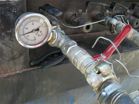
Pressure gauge for test
2.(Geological Site Investigation)
Center of foundation and prospecting - Geotechnical Department of LECM, which is a prospecting centre with independent technique and well experience on civil constructions and high quality in the aspect of geological site investigation, providing geological site investigation service and assessment on the geological parameters for the kinds of future development project in Macau. Site investigation is including in vertical drilling and inclined drilling and environment boreholes with the depth more over 100m and collecting samples of soil and rock and underground water for performing different kinds of laboratory tests. In-situ tests are including the Standard Penetration Test, Cone Penetration Test, Vane Shear Test, Soil and Rock Layer Permeability Test, Rock Impression Packer Test etc. gINT software system is used to integrate the geological information also.
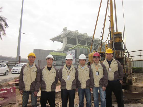
(Site Investigation Team)
2.1 Geological Boreholes
During the planning and design period of a project, it is necessary to perform geological borehole around the site area to acquire geological information for the designer. For 25 years recently, most of the geological boreholes from government construction projects have been completed be NFP of LECM such as Macau International Airport project, Chinese People’s Liberation Army (PLA) Camp, the new building of State Council of the People’s Republic of China (CPG) in Macau, Sai Van Bridge of Macau, Stadiums for 2005 East Asian Games, Macau LRT system project, tunnels project, Artifi cial Island in Macau for Hong Kong-Zhuhai-Macao Bridge and Reclamation Zone A and Zone B in Macau etc. Geological borehole is to drill a hole vertically or a hole with inclination from ground surface to investigate the thickness of soil/rock layers. Underground water samples, soil and rock samples can be taken during the geological drilling process. The physical parameters of the samples, which are the important basis for the engineering planning and design, can also be obtained by a series of laboratory tests.
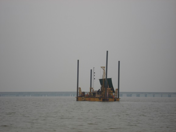
Site investigation on sea area
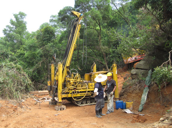
Inclined borehole on mountain
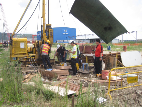
Site investigation on land
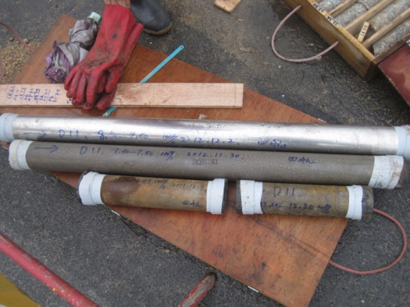
Soil samples taken for different kind of soils
2.2 In-situ Tests
During the borehole drilling process, physical properties of soil and rock strata can be measured by in-situ tests. General in-situ tests for geological investigation include the Standard Penetration Test (SPT), Cone Penetration Test (CPT), Vane Shear Test (VST), Schmidt Hammer Rebound Test and Underground Water Pumping Observation.
SPT is to measure the standard penetration number (N value) when the hammer penetrates into soil with 45cm depth.
CPT instrument, to measure the friction parameters of soil
VST is to measure the shear strength of soil
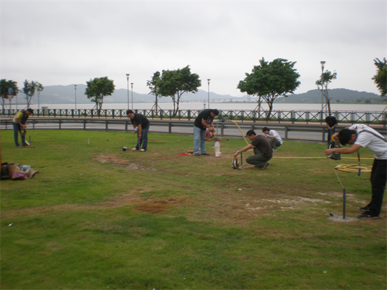
A excavation of well was used to measure the falling velocity of the underground water level
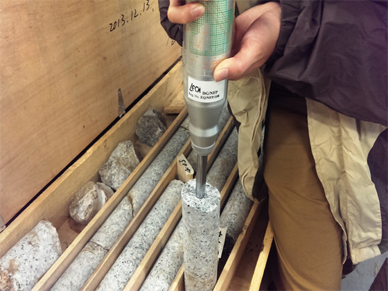
Rock sample grade estimated by Schmidt Rebound
2.3 Special In-situ Tests
For satisfying the design requirement of waterproofi ng (i.e. tunnel and basement), the permeability of soil strata and rock strata and the quantity and orientation of cracks in the rock layer can be measured by special in-situ tests during the borehole drilling process. Special in-situ tests for geological investigation include 1.In-Situ Permeability Test for soil stratum and Packer Water Absorption Test for rock stratum, 2.In-Situ Impression Packer Test.
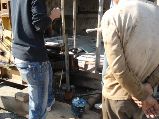
In-situ permeability test for soil stratum is to measure the permeability coeffi cient of soil
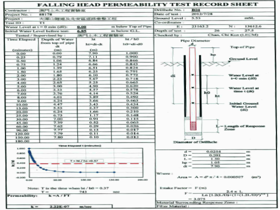
Test report of insitu permeability test
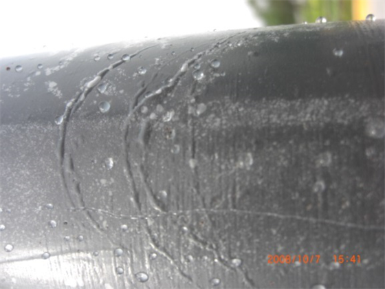
The cracks were impressed on the fi lm after the in-situ impression packer test completed
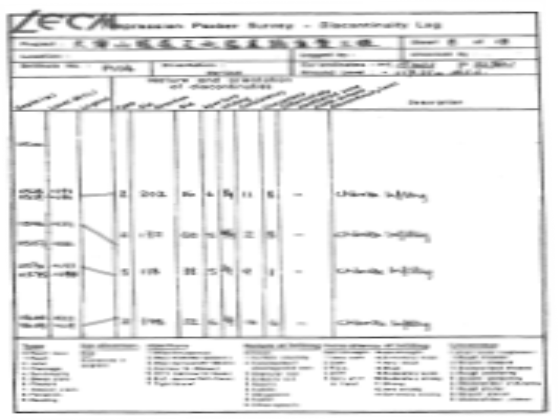
Test report of in-situ impression packer test
2.4 Field Inspection and Reception
NFP is the centre to inspect the drilling equipment, the methodology of drilling, the terminated depth, category of soil, Total Core Recovery (TCR), Rock Quality Designation (RQD) and the Grade of the rock for the assessment on the quality of borehole and on that whether the borehole complies with the requirement from designer. In addition, when bored piles and diaphragm wall are completed, interface core-drilling should be carried out at the concrete/rock interface as the reception criteria of each pile and diaphragm wall for the post construction proof drilling.
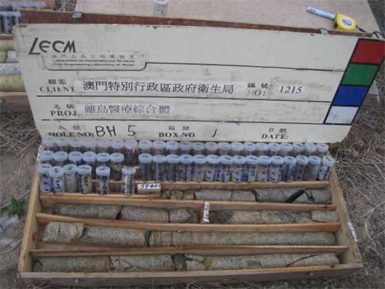
Inspection for the category of soil, TCR, RQD and the Grade of rock
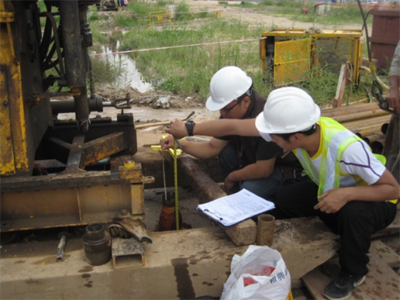
Inspection and reception for the terminated depth
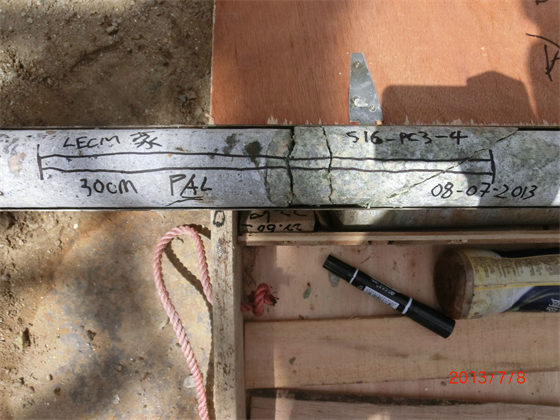
Inspection for the interface core drilling at the interface of concrete and rock
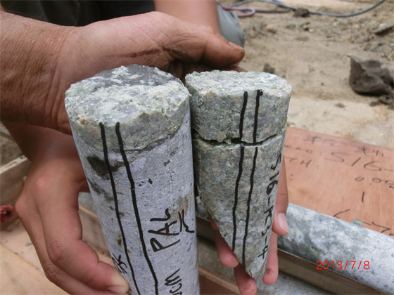
Inspection for the interface core drilling at the interface of concrete and rock
2.5 Geological Analysis Report
gINT software system is a geological analysis program, which can provide an integrated geological report including borehole log report, rock log, geological cross-section profile and analysis chart of in-situ tests, based on the results from geological borehole and in-situ tests. This geological report should be a very reliable basis for the design of the project. Furthermore, all the geological information can be integrated by gINT for the establishment of Macau Geological Information Database.
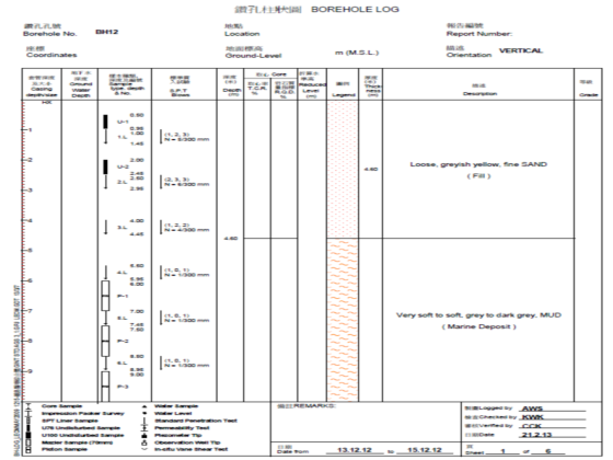
Borehole log report for the vertical distribution of soil/ rock strata
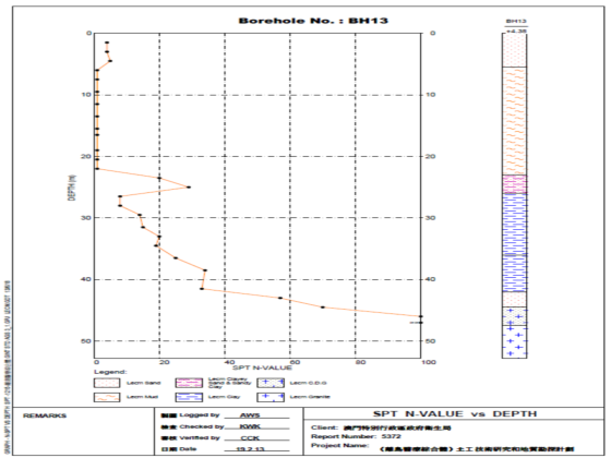
SPT VS depth curve can be charted at each soil stratum
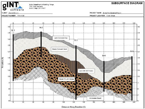
Geological cross-section profile can be drawn by different borehole data
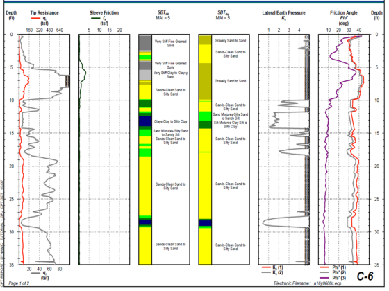
Test data and chart from in-situ tests (CPT) can be plotted
2.6 In-Situ Survey and Stakeout
Mobile GPS collector, which is used for staking out the locations of boreholes based on the designed location before starting the geological drilling works, and for surveying the coordinates and the elevation of the boreholes after fi nishing the geological drilling works. This GPS collector can connect to the data server of DSCC for acquiring the correction for the Macau Coordinate System through the 3G connection from CTM and perform the survey works and stakeout works using the corrected Macau Coordinate System.
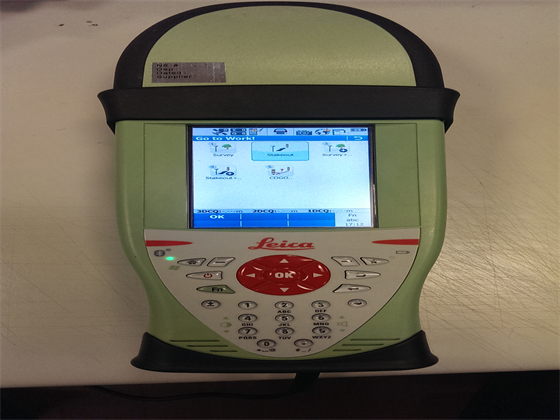
Mobile GPS collector
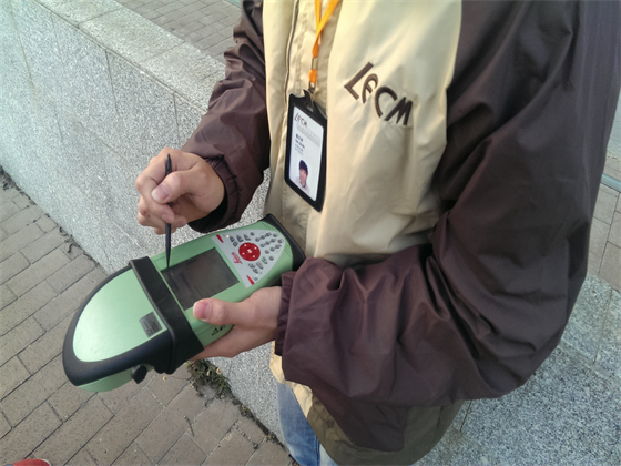
Stakeout of the locations of boreholes using the mobile GPS collector
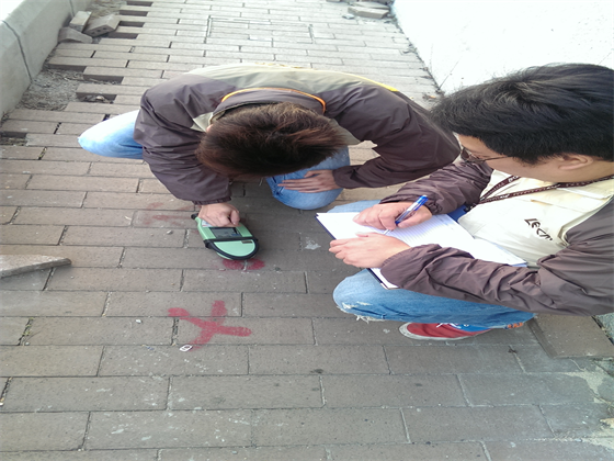
Surveying the coordinates and the elevation of the location of borehole using the mobile GPS collector
3.Geotechnical Monitoring
NFP is a centre providing geological monitoring services for kinds of project (reclamations, tunnels, deep excavations, house foundations and slopes) processing in Macau. Monitoring works are including in: settlement of ground and deep soil layers, ground displacement and lateral displacement of deep soil layers, pore water pressure, underground water level, inclination monitoring of structural foundation, strain monitoring of strut and waling system and slope automatically monitoring, etc. Also the monitoring works are related to the observation for the construction stage and the long term safety observation after the construction, and the monitoring results can be used to guide the safety construction and make the safety use of the facility.
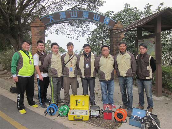
Geotechnical Monitoring Team in TAI TAM HILL for Slope Automatic Monitoring
3.1 Settlement and Displacement Observation
Settlements can be divided into ground surface settlement (settlement point or settlement plate) and settlements of soil stratum at different depths (Sondex casing installed by drilling), and displacements can be divided into ground surface displacement (displacement point) and displacements of soil stratum at different depths (inclinometer casing installed by drilling). Settlement and displacement observation must be considered item in a monitoring plan for different kind of civil construction especially for the reclamation project, tunnel project, deep excavation project and the foundation project of buildings etc.
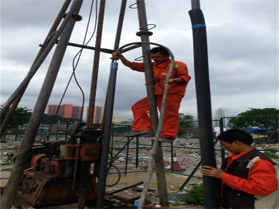
Installation of Sondex casing
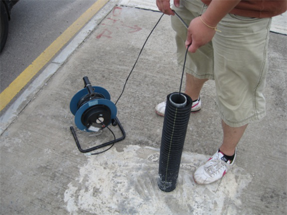
Sondex sensor was used to measure the settlement of soil stratum at different depths
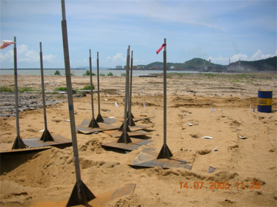
Surface settlement (Settlement plate)
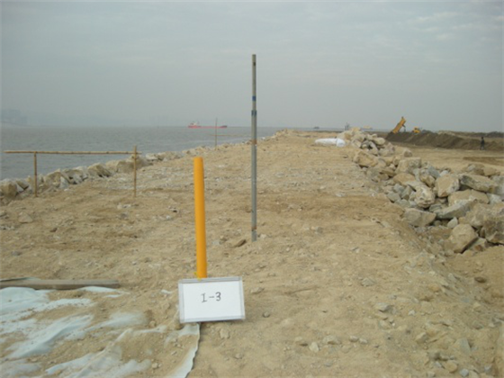
Inclinometer and settlement plate installed on dike
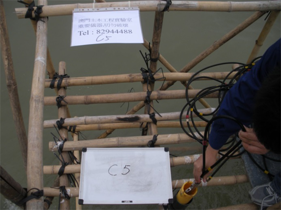
Inclinometer installed on sea. Horizontal movement of sea bed can be measured by inclinometer probe.
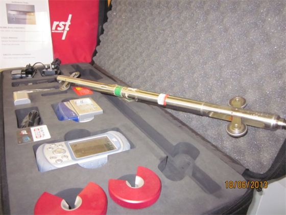
Inclinometer probe
3.2 Pore water pressure and underground water level
Pore water pressure observation is used to analyze the stable status of soil during consolidation of soil and during the period excavation and backfilling. Underground water level observation, is used to analyze the change of underground water level in soil strata because it is an important parameter for the assessment on the settlement of soil and for the design and construction of the structures under the ground. The equipment for pore water pressure includes open piezometer, pneumatic piezometer and electric piezometer. Underground water level observation is to be monitored through the excavation of water observation well and the installation of standpipes.
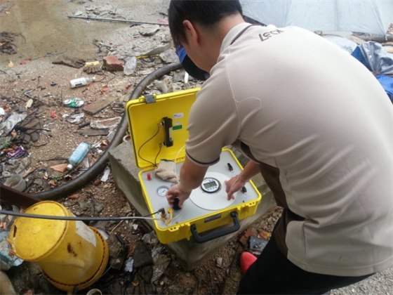
Pore water pressure observation
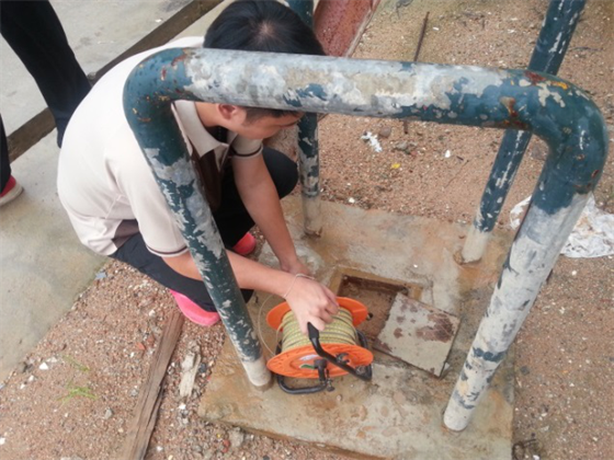
Underground water level observation
3.3 Strain Observation on Strut and Waling System
For the internal force observation on the strut and waling system for deep excavation, it is usually to be installed, that the strain gage is used to measure the strain value of the internal force, on the strut and waling structure. The internal force of strut and waling member can be calculated from the measured strain value based on the material properties. Load Cell is the most effective method for measuring the internal force of the strut and waling system. Both strain gage and load cell can be connected to a data-logger to measure the strut and waling system automatically.
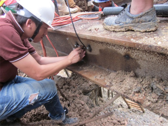
Strain gage installed on strut system for measuring the strain and the internal force
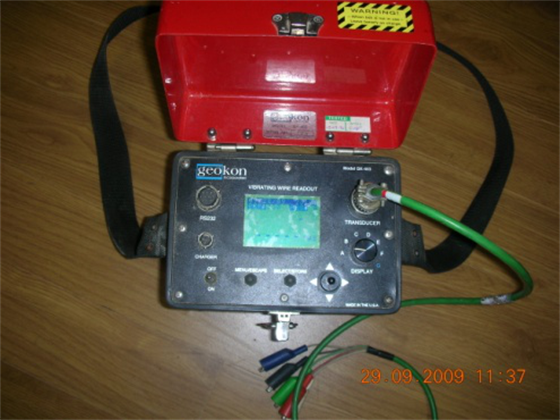
(GK-403 Vibrating wire Readout)
3.4 Settlement and Inclination Observation for Structures
Settlement and inclination observation for structures around the construction site (such as deep excavation, piling works and backfi lling etc.) are usual in a monitoring plan. The normal method for the settlement and observation for the structures is using settlement marker which is installed on the structural member of a building and then survey the elevation of the settlement marker using leveling instrument. It is also to drill a borehole below the ground and install an extensometer in the borehole to measure the settlement of the structure using specified data acquirement instrument or using automatic monitoring data-logger.
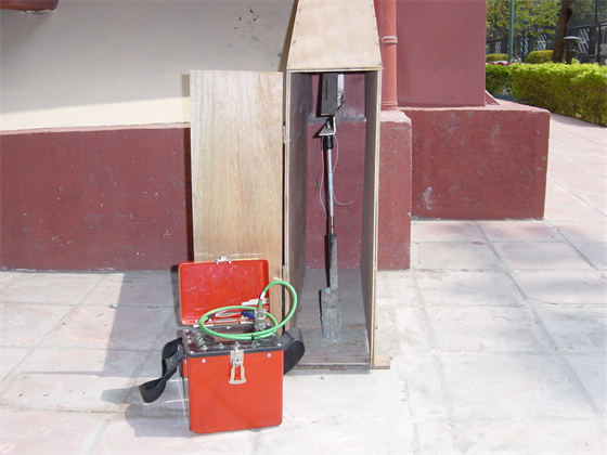
Extensometer is used to measure the settlement of a structure
For the inclination observation of structures, Tiltplate and Tiltmeter or Clinometer are the common instrument which are installed on the structural member of building in Macau and they can also be connected to the automatic monitoring data-logger.
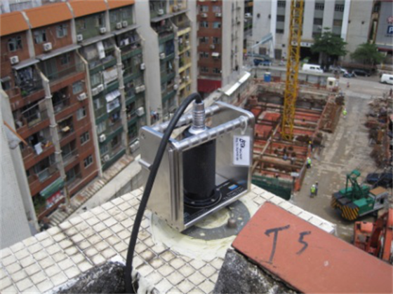
Measuring the Tilplate
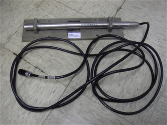
Installation of Tiltmeter
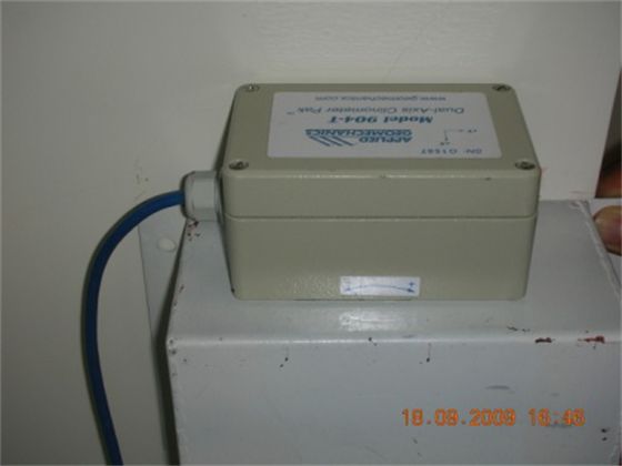
Installation of Clinometer
3.5 Slope Automatic Monitoring System
TAI TAM HILL is at East of Taipa, near by Macau International Airport. For early years, it was a landfi ll with rubbish and stopped operation in 1988 because of saturation of landfi ll. It was afforested and reconstructed to public recreation area in 2001. Recently, deformations on the slope, settlements and tension cracks on the roads and existing buildings were found. Thus, LECM is the fi rst to introduce the slope automatic monitoring system to perform the slope monitoring and slope stability assessment for TAI TAM HILL.
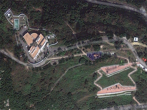
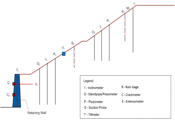
The location chart for monitoring instrument installed along each monitoring cross-section
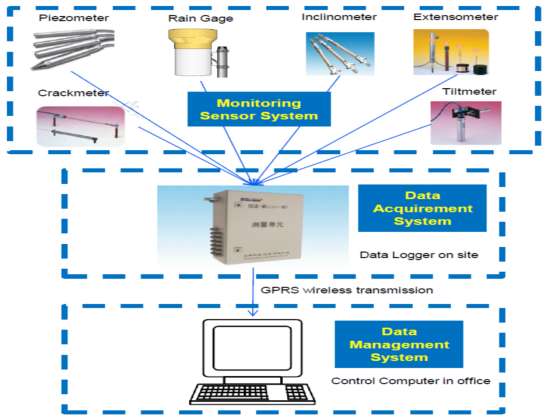
Slope automatic monitoring system consists of three sub-system (1) Monitoring Sensor System, (2) Data Acquirement System, (3) Data Management System
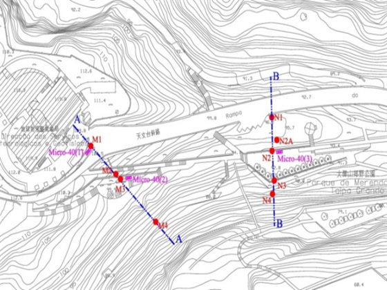
2 selected monitoring cross-section of Slope Automatic Monitoring System for TAI TAM HILL
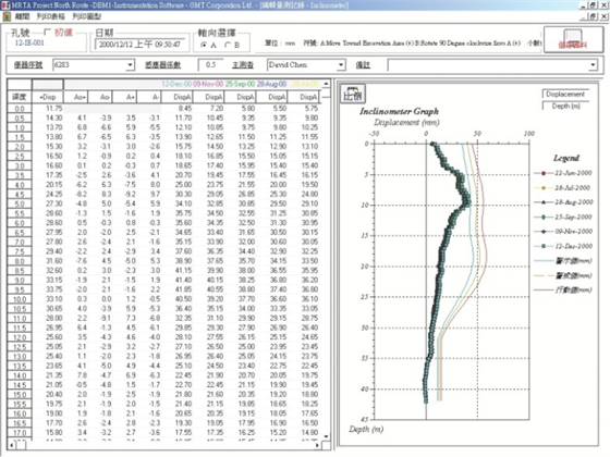
Slope Automatic Monitoring System has the function that the data can be acquired and be charted by the system automatically
4.(Design and Analysis of Consolidation of Soft Soils)
NFP has the analysis ability of complex geotechnical engineering problem. We can also perform a professional analysis for consolidation of soft soils, dyke construction, reclamation and slope stability, including calculation of settlement, consolidation and capacity of soft soil, in the condition of reinforcement with sand pile and drainage plate etc. Analysis of settlement and stability of existing and new dyke are included also. At the present, NFP has in charged and fi nished the design of soft soils foundation treatment in the general medical facilities of SSM in Coloane, and the analysis of stability of the vertical dyke in Fai Chi Kei, Macau.
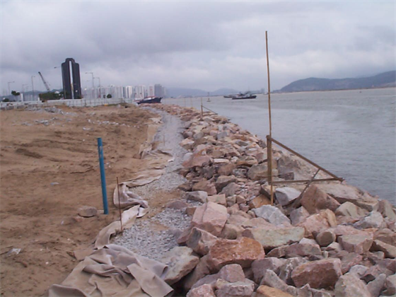
Reclamation
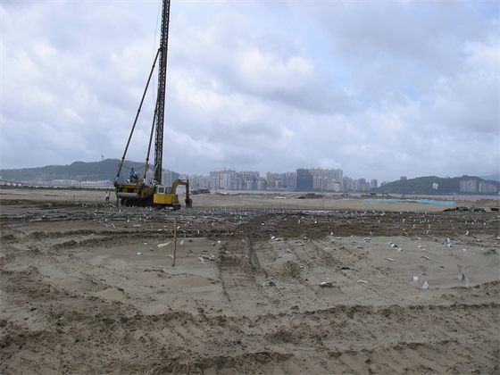
Soft soil foundation treatment
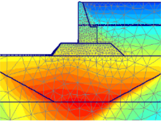
Sea dike analysis
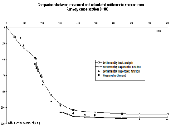
Settlement analysis


